I have been wanting to try out using a drone, so this summer I rented one and used it in a couple of different spots near the Alpine Tunnel.
The video below is a mix of drone footage and photos. This shows a portion of the grade just after it exits from roughly 2 miles of wooded right-of-way and begins to cling to the mountainside before reaching the eastern portal of the tunnel. I've always loved this section of the roadbed. I, of course, love the western side of the pass too, but because the east side was never converted for auto traffic, you can feel the narrow-ness of the grade a bit more. This was one of my first uses of a drone so please pardon the jerky motion of parts of the video.
Historical photos:
1. James Ehernberger Colleciton
2. Tom Miller Collection
Sunday, September 23, 2018
Sunday, September 16, 2018
Ride the C&S over Rocky Point: 2018 video
Imagine riding the Colorado & Southern Railway upgrade from Como, over the summit of Boreas Pass on the way to Breckenridge, Colorado. Here I walked one of the few portions of the right-of-way that was not turned into an auto road. This spot, between Como and the summit of the pass, was called Rocky Point. It demonstrates the incredible beauty and inherent danger of narrow gauge railroading. A short piece of restored track graces the spot. I have heard that groups will occasionally ride a push car over this little stretch. This was one of my first uses of a GoPro, so please forgive the rocking motion of the footage.
Audio is from: Sounds of Steam Locomotives No. 3: Colorado Narrow Gauge Stack Music. "Three Little Engines and 33 Cars."
Audio is from: Sounds of Steam Locomotives No. 3: Colorado Narrow Gauge Stack Music. "Three Little Engines and 33 Cars."
Friday, September 7, 2018
Rocky Point photos
The DSP&P crossed the mountains from Como to Breckinridge on its way to Leadville via Boreas Pass. Sometime after abandonment, the roadbed was converted to a dirt auto road. At one spot, called Rocky Point, the auto road leaves the original train roadbed for a short stretch to avoid rock work used by the railroad since it was too narrow for two-way auto traffic. At this spot, a short stretch of narrow gauge track was relaid on the protected, original right-of-way. Below are the photos I took as my family explored this little gem.


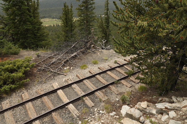


On an little pamphlet that I picked up many years ago it states: "Here a stretch of original railroad grade remains unaltered due to expensive rockwork required to widen it for auto travel. (A few back-East rail passengers probably got a little green around the gills as those narrow gauge cars swayed around this sharp turn.)"
Subscribe to:
Posts (Atom)