Showing posts with label bridges. Show all posts

Saturday, March 1, 2025

Exploring Clear Creek Canyon on the C&S: Bridge No. 703 (video)

In a previous video I showed the location of Forks Creek today. In a subsequent video, I showed the site of Bridge 705, with abutments still in place. This next video shows the grade between these two points. 

In this video we explore the remains of the Colorado & Southern Railway's Clear Creek District route starting from Forks Creek and headed west toward Idaho Springs. We visit the site of bridges No. 703 and 704. While much of the roadbed is gone, one can still imagine the route of the old narrow gauge through the canyon. Later the railroad bed reappears and rock cribbing is still evident.

Tuesday, January 28, 2025

Exploring Clear Creek Canyon on the C&S: Bridge No. 705 (video)

In May 2024 my family and I explored a short segment of the C&S narrow gauge grade in Clear Creek Canyon where the railroad went around a mountain that the road tunnels through. This segment is a little short of a mile west of Forks Creek. 

Part of the C&S grade is now a walking trail. The site of bridge No. 705 (previously No. 5) is also explored. The bridge abutments can be seen off of the side of the trail. You can also see a good amount of rock cribbing from the railroad.

Tuesday, July 18, 2023

Why didn't the Keystone (Mill Gulch) bridge end up in Denver?

Not long ago, I posted a video (see below) showing the former South Park Keystone Bridge (also known as Mill Gulch Bridge) in Helen McGraw Tatum Memorial Park in Bailey, Colorado.  I found a little more background on why it didn't end up in Denver as planned (as discussed in this 1977 Rocky Mountain Rail Report).  The information came from pages 393 and 396 of The Mineral Belt Vol II -- Old South Park -- Across the Great Divide published in 1978 by David S. Digerness

"The road below the dam would make one crossing of the South Platte River at the location of the existing narrow-gauge railway bridge at Keystone.  That structure will be replaced with a steel-beam concrete-deck bridge, with a 22-foot running surface employing the existing bridge abutments.  It is planned that the historic Keystone bridge will be carefully dismantled, and each piece will be marked and stored at Kassler for future use whenever an appropriate site is located.

"It is interesting to note that the Keystone bridge was offered to the City and County of Denver by the Denver Water Board in the fall of 1977.  The bridge was to have been used as a pedestrian crossing on the South Platte River in the city – positioned so that the Auraria campus parking lot could have been used for public parking during Bronco football games.  However, the U.S. Bureau of Land Management (BLM) stepped in and said the bridge belonged to them and the Denver Water Board could not give it away because they did not own it.  It seems that when the railway abandoned their right-of-way, the bridge was left behind – and bridge, right-of-way and all reverted back to public domain administered by the BLM."

Some other info on the process of dismantling the bridge in 1978 can be found here from the Rocky Mountain Rail Report.


Sunday, June 4, 2023

1978 C&S News (2) Test car at Climax, Argentine Central, Mill Gulch bridge removed

A wealth of railfan history exists in the archives of the Rocky Mountain Rail Report, the newsletter of the Rocky Mountain Railroad Club started in 1939.  Here is some more miscellaneous South Park Line/C&S-related news from the 1978 editions.   

1978

July

(High altitude car testing on Leadville-Climax branch)

GP 40X No. 90000 with EMD Test Car at Malta, Colorado prior to movement to Climax, Colorado for high altitude testing. After leaving Climax on the Leadville - Climax branch, the train passes French Gulch Tank. A remnant of the days of steam, the tank still holds water after all these years. February, 1978. 

August

(Club to Walk the Argentine Central and Ride the Loop)

ROCKY MOUNTAIN RAILROAD CLUB DAY AT THE GEORGETOWN LOOP HISTORIC MINING AREA - Whether you wish to use your feet or your seat, Saturday, August 26 will be THE day to visit the Georgetown Loop Historic Mining Area, when the club will hike a portion of the Argentine Central Railroad bed and ride the rails of the Georgetown, Breckenridge and Leadville Railway. 

We have made special arrangements for an all-day unlimited ride ticket on the GB&L. A full freight consist will be used, with the train departing Silver Plume on the hour from 10:00 A.M. to 5:00 P.M., and on the half-hour from the platform at the lower end of track. If all goes well, there will be steam powered double heading on several of the afternoon runs, with photo runs on the 4:00 P.M. and 5:00 P.M. trips. Your $5.00 ticket (regular one- ride fare is $3.50) or $2.50 child's ticket (ages 5-15 inclusive) will provide the holder with unlimited rides throughout the day. The railroad is now 2 ½  miles long, and has been extended almost to the abutment of the high bridge. The train does stop to let off and pick up passengers who desire to tour the Lebanon Mine, which just opened this year. $1.00 tickets for this tour may be obtained at the railroad's ticket offices or at the mine. 


The other portion of the day's activities will consist of a hike from Silver Plume over the old roadbed of the Argentine Central Railway. When the railroad was constructed, the Argentine Central was the highest adhesion railroad in the U.S., climbing 16 miles to the top of Mt. McClellan (over 13,000 feet) on 6 percent grades and numerous switchbacks. Built in 1905 for freight and tourist service, the line gained national fame but never the¬ less, survived only until 1918. Our walk will leave Silver Plume, about 1/3 mile west of the Silver Plume depot on the south side of 1-70, at 9:00 A.M. Leading the group, will be Dan Abbott, Argentine Central enthusiast and author of the book STAIRWAY TO THE STARS. The hike is about a four-mile round trip over a roadbed that is in remarkably good condition, with no cross¬ country up-hill type hiking involved. Although the railroad has been gone for almost 60 years, an occasional spike or trace of a tie can still be found, several interesting mine loading structures still stand, and stone walls and a "terraced" 15-foot-high stone retaining wall in excellent condition can be seen. 

Good walking shoes are recommended, of course, and a pair of binoculars might even come in handy on this leisurely hike. It will take about two hours to reach Pavilion Point, our destination high above Georgetown. There, hot foot and cold drinks will await our arrival as Ranniger's Roadbed Commissary will be in full operation next to the old stone chimney, and the last remnant of the Pavilion that was once situated there. After hearing and observing the train operating in the valley, one-thousand feet below, and engaging Jim's delectable Ballast burgers and accompaniments, everyone will then head back down grade for an afternoon of riding the GB&L. A charge of $3.00 per person for the hike will provide for a handout and map of the Argentine Central, as well as the hot lunch. We ask that you order your tickets in advance, or pick them up at the August meeting, so Ranniger's Roadbed Commissary can plan ahead and that we will have ample handouts. Railroad tickets ($5.00 adult, $2.50 child 5-15) need not be ordered in advance, but should be purchased at Silver Plume depot on August 26. Just mention that you would like a ticket for the Rocky Mountain Railroad Club Day. 

We think this should be a real fun time, so come on up and take the walk, ride the train, or both. Bring the whole family. Friends and guests are welcome, of course. Any questions, call Darrell Arndt at 321-2723, till 11:00 P.M. 


September

(Argentine Hike review and doubleheaders on the Loop)


GREAT WEATHER greeted the participants of the club's Argentine Central hike out of Silver Plume on August 26th. Led by Dan Abbott, the group negotiated some 2 1/2 miles of grades and switchbacks to reach Pavilion Point, where Ranniger's Roadbed Commissary was ready and waiting to do business. Plenty ofJ im's tasty Ballast burgers, home-cooked beans, chips, cookies and lemonade were provided to eliminate the hunger pains. Whether sitting under the trees, or out on the point where one could look down the valley on Silver Plume and the Georgetown Loop 1,000 feet below, the old stop on the railroad provided a very scenic spot to enjoy lunch. Upon return to Silver Plume, many took the opportunity for a ride on the Georgetown, Breckenridge and Leadville Railway, or several rides with the unlimited ride ticket. Doubleheading was done on a number of runs, with a photo run on the 5:00 P.M. trip. Don Smith and members of his German Band provided music on the train, much to the delight of the passengers. We would like to thank all those whose efforts and contributions made the day so enjoyable, especially Dan Abbott, Ranniger's Roadbed Commissary, Lindsey Ashby and his crews, Roy Altenbach, Centennial Publications, and Don Smith and friends! 


October

(Dick Kindig shares slides of the C&S Clear Creek Line)

It was no surprise that Dick Kindig came through with a very interesting program of slides. We saw the Southern Pacific's famous narrow gauge operation in California, then the West Side Lumber Company while it was in operation. Of particular interest to those of us who never saw it intact were scenes of the C&S line in Clear Creek Canyon. Views included the Forks and at the High Bridge on the Georgetown Loop. Dismantling shots of the narrow gauge line were also shown. Rio Grande Southern selections included Lizard Head Pass, trestles and activity at the Ridgeway depot. The San Juan was quite a passenger run, and views of it along its route were well received. We certainly do thank Dick for sharing some of his photographic encounters with us. He provided memories for some, and an education for others who had not experienced first hand, a segment of the West's more colorful period of railroading. 


November


(Mill Gulch Bridge in Platte Canyon Removed)

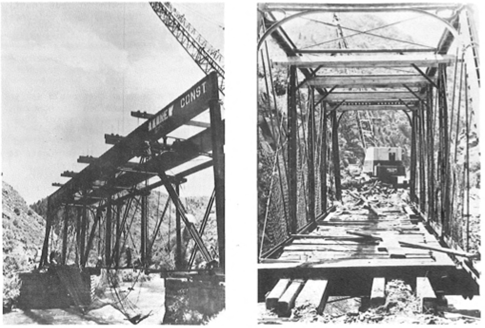
THIS WAS THE SCENE in the Platte Canyon this summer, when crews began to dismantle the Mill Gulch Bridge (or as it is now often referred to, the Keystone Bridge). 

Mill Gulch Bridge in the process of removal.  Photos from Rocky Mtn. Rail Report Nov. 1978

The Denver Water Department is in the process of widening the narrow gauge roadbed farther into the canyon, to permit access by heavy construction equipment, so the bridge had to be replaced. The large girders at the top were used to support the structure as it was carefully taken apart. They were then lowered onto the abutments to become the main supports for the new bridge. The old bridge is now in storage, and is to be given to the Forest Service, who has indicated it will be used near the Keystone Ski Area. The 10-mile long Platte Canyon was the only major canyon in the foothills near Denver, that had been available for hiking, biking, fishing, etc., with no competition from the automobile. It was closed to all public access this summer, and it may be years before it is open again. This bridge was a highlight on the club's Platte Canyon Bunion Pounder walk/ride trip last year. 

(ed. Mill Gulch Bridge today)

(Calls to paint coach on display with C&S 74 in Boulder)

AFTER MANY YEARS of contending with the elements, the narrow gauge display in Boulder's Central Park is sorely in need of some attention in the way of paint. This year, the city decided to have the locomotive No. 30 painted, but the coach and caboose were left untouched. So the Boulder Historical Society has taken it upon itself to try and get the coach painted before bad weather sets in. It is in need of assistance, however, in the form of either time or money. Mike Rowe is the coordinator on the project, and will set up a work day in November, and would appreciate hearing from anyone who could spare just a little time on a yet-to-be-determined Saturday or Sunday to help get the job done.

When a date is set, he will then notify those interested. Paint will be provided, of course, and plans are to return the coach to a Pullman green color. Mike can be reached during the day, at the Boulder Historical Society, 449-3464, or at home in the evenings at 442-2164. The more who can help, the quicker it will go on this worthwhile project. 


December

(Shay No. 8 comes to the Georgetown Loop)

COLORADO AND THE GEORGETOWN, BRECKENRIDGE & LEADVILLE RAILWAY gained another steam locomotive recently, with the arrival of ex-West Side Lumber Company's 3-foot gauge Shay Locomotive No. 8 at Silver Plume on October 12. The locomotive was trucked all the way from Banks, Oregon, and presented some challenging problems during the move, Parts had to be removed to get it down to a truck-able load, and it took several weeks to make the journey (and a truck with 11 axles and 66 tires!!). It is hoped to have it operational on the Georgetown Loop by the middle of next summer. 

Shay 8 on display in 2004 - Nathan D. Hale photo


Wednesday, May 17, 2023

Mill Gulch bridge and Glen Isle way station video

 Back in the fall I had a chance to explore the C&S' Platte Canyon route starting in Bailey.  I hadn't really heard much about the Helen McGraw Memorial Park until I went and I didn't know that it had some great C&S-related items.  I put this video together to showcase two main structures there: the former Mill Gulch bridge and the Glen Isle way station.  They also have a wooden C&S caboose, but it's standard gauge.  Unfortunately, the park is hidden behind a number of retail buildings and I think it would be easy to not know it's there.

Enjoy,

Kurt


Friday, November 11, 2022

A First Visit to Platte Canon, part 1

  When I interact with C&S fans online, it’s encouraging to know that I’m not the only one who lives far, far away from the railroad I enjoy so much.  Living in Ohio doesn’t afford me many opportunities to just hop over to the lovely state of Colorado, but in October of 2022, a surprise opportunity presented itself.  

My oldest daughter, Mia, a senior in high school, got very interested in a Bible-based gap-year program based in Canon City, Colorado named Worldview at the Abbey.  My wife and I loved the vision of the program and our daughter’s excitement about the possibility.  Still, sending our oldest across the country by herself without having made a personal visit as parents first seemed a bit intimidating so we signed up for a preview weekend in October.  

The main point of this trip was, of course, for me to check out the program with our daughter, but the chance to visit Colorado, even for a mere two and a half days set my mind ablaze with what C&S visits I could make!  I got to work checking out the routes we could travel via the DSP&P Historical Society’s Google Earth overlay and corresponding with the ever-helpful Tom Klinger, co-author with his wife Denise of five stellar C&S books.  

Map of ROW and new walking trail


Because our flight was to arrive in Denver around 1pm on Thursday, we basically had Thursday afternoon and evening and Friday morning for C&S adventures before the Abbey preview weekend program began Friday afternoon in Canon City.  Tom Klinger helped me work out an itinerary for my available time.  This itinerary began with a visit the Colorado Railroad Museum Thursday afternoon and even a possible short hike on one of the new walking trails built partially on the old C&S line up Clear Creek Canyon.  After this, the Klingers had graciously offered us dinner at their place in Wheat Ridge, just next to Golden.  For Friday, our plans included getting to Canon City by the back route via Route 285 in Platte Canyon, as I had never been east of Kenosha in past Colorado visits.

Disappointingly, our first plans were blown off the track like a boxcar in the South Park when our plane to Denver was delayed a frustrating three hours.  By the time we at last landed and got our rental car (which required another hour of waiting in line), we were at least glad we could visit with the Klingers whose hospitality and company were simply a delight.  As I am in the process of writing a C&S book, it was a joy to hear Tom and Denise relate their completely unplanned foray into becoming authors after A.A. (Brownie) Anderson’s son shared his family photo albums with Tom and kept saying, “Tom, I want you to write a book.”


My daughter and I woke up Friday morning to a dreary day.  On our way south to catch 285, there were times we could barely see the car in front of us through the fog.  This was not an encouraging prospect for sight-seeing!  When we later crested the mountains, the misty, foggy morning finally gave way little by little and the sun came out.  Our sights were stunned to see the Rockies awash with a mix of deep green pine trees juxtaposed by stunning yellow aspen leaves.  For us flat landers, it was an act of spontaneous praise to the Creator as we barked one “Woah!” and “look at that!” after another.

Due to our need to arrive in Canon City by 2:30pm, we had to make a few cuts or short visits along the way.  I wanted to visit Pine to see the two gondolas on display, but since I could not figure out a way to get from Pine, which required a drive down Pine Valley Road off of the highway, to Bailey without backtracking to 285, we skipped it.

Bailey


With anticipation we entered South Park railroad country at last as 285 makes a sweeping right hand curve in the old town of Bailey.  We pulled off to the left in the center of the curve.  Helen McGraw-Tatum Memorial Park was easily visible straight ahead of us behind a shop bearing a William Jackson photo of a Mason Bogie and a coach near the Alpine Tunnel.  The first sight to see was an old South Park railroad bridge across the North Fork of the South Platte River leading to a footpath.  

We rolled over the gravel, parked on what was likely the South Park right-of-way, and walked over to a delightful small park dedicated to an adventurous woman who loved the history of this area.  Helen McGraw-Tatum is known to many C&S fans for her film recording of C&S No. 9 hauling the last passenger train in April 1937.  

Spanning the creek is the old Mill Gulch bridge from Platte Canon.  We walked across the ornate bridge several times with it’s ornamental “Keystone Bridge” sign high up on top.  A note in the November 1977 Rocky Mountain Rail Report gives a little background on the structure.  

Mill Gulch Bridge

THE HISTORIC MILL GULCH BRIDGE, or as it is now referred to, the Keystone Bridge, (it was built by the company of the same name) will have a new resting place near downtown Denver if all goes as planned. The Denver Water Board has offered to dismantle and move the old DSP&P bridge from the canyon, and reassemble it across the South Platte River near Denver's Mile High Stadium.

A permanent bridge is needed at the location to provide fans attending events at the stadium, a way in which to cross the river from certain parking areas. The Water Board has to replace the bridge in the canyon with a stronger one (which will use the same abutments) to allow movement of heavy construction equipment. It was the intention of the Board to disassemble the bridge anyway, and store it until a worthy recipient could be found. So it will now be preserved and used, although not in quite as picturesque a setting.

The bridge was taken apart in the summer of 1978.  In the November Rocky Mountain Rail Report the following was explained, along with a new plan for the bridge’s use.

The Denver Water Department is in the process of widening the narrow gauge roadbed farther into the canyon, to permit access by heavy construction equipment, so the bridge had to be replaced. The large girders at the top were used to support the structure as it was carefully taken apart. They were then lowered onto the abutments to become the main supports for the new bridge. The old bridge is now in storage, and is to be given to the Forest Service, who has indicated it will be used near the Keystone Ski Area.

The bridge was never used in Denver or the Keystone Ski Area, but was instead put back together and placed in Bailey in 1985.

Glen Isle and Grousemont

Next, we visited the old Glen Isle way station to the left of the Keystone bridge.  Originally located at the Glen Isle resort just a bit west of this spot, the open air station had been restored in 1994 by combining it with another way station from Grousemont.  Inside, one can look up and see signatures of passengers who put their names here while waiting for trains.  Unfortunately, it is a bit hard to decipher which are original as many recent visitors seem to have kept up the tradition of adding their names.  Still, some are dated from the 1920’s and ‘30s.  


To the left of the Glen Isle station, a C&S standard gauge caboose, donated by the railroad in 1973, rests on what was the South Park’s right-of-way.

 
From there we hopped back onto 285, now a two-lane highway and right on top of the former C&S roadbed.  We passed Glen Isle where the old hotel with its rounded front, dating from railroad days, still stands on your left.  Of many resort hotels along the South Platte River, it is the only one still standing and serving vacationers in the canyon.

Maddox


Our next marker was to look for Fitzsimmons Middle School and Platte Canyon High School on our right as a marker to remind us to look for the old Maddox Ice Pond on our left, where scores of C&S cars were loaded with ice on a siding that could accommodate 48 cars.  Once we passed the school, we easily
identified the large square, man-made lake still glistening in the fall sunshine.  We pulled off onto a left hand driveway and took some photos of the lake, and then ran across the street to a gated driveway.  This path was a rutted dirt road which connected with the old right-of-way where it veered to the right away from 285, leading to a ranch called Mile High Anglers, a provider of guided fly fishing tours.


Cassells

We headed back on the road, this time with the roadbed on our right.  It was hard to see traces of it, especially as the driver!  We made two quick stops near what was called Cassells in early railroad days.  The site once hosted a resort built and operated by the Cassells family and it also sported a siding large enough for five cars.  In 1930 the property was sold and given to Catholic Charities and rechristened “Santa Maria,” a camp for underprivileged children.  Today it is a YMCA camp, where one can still see the enormous, 55-foot tall 1930s-era statue of Jesus with outstretched hands named “Christ the King”  on the side of a mountain rising above the North Fork of the South Platte.  We made a quick stop to snap a photo of this at a turn off in the road.

We made another short stop in the Cassells area to find where the railroad’s roadbed crossed 285 from right to left.  The ROW runs through a property on the right, passing a shed and then a house.  The roadbed seems to be used today as the driveway.  We photographed and filmed that, but when we crossed the highway, we were unable to find any roadbed traces easily visible from the road.  


Grant

While I wanted to stop in Grant where a bridge that was part of the end of the wye is still in use for a road, I decided to skip it, knowing it was on private property, and I was not sure how close I could get.

*******

In part 2, I'll continue our trek onto Webster and over Kenosha Pass to the great South Park.


Thursday, March 8, 2018

A Tale of Two Chalk Creek bridges

I don’t know much about this, but I found a 2011 online article about work on what is referred to as “The Chalk Creek Railroad Bridge” by the HistoriCorps.

from HistorCorps site
The site states that the bridge “was built in the 1880s and was used to access the mines in the area.  It was built by the Denver, South Park and Pacific railroad to accommodate narrow gauge trains from the Mount Princeton area to the mining towns of St. Elmo and Hancock.  Until the bridge’s closure in May 2011, the trail was used extensively by summer and winter recreation enthusiasts.”

The reference to being used on a trail makes me think this is on the Narrow Gauge Trail mentioned in this post.  Does anyone know?

The HistoriCorps state that the bridge “was closed due to safety concerns.”  They proceeded to “remove the rotted bridge deck and girders and replace it with new girders and plank deck; construct safety railings to United States Forest Service specifications; and repoint the historic stone abutments.”

I was unable to find any follow up to this work online.

Photo by Historic American Engineering Record, Library of
Congress collection, via Bridgehunter.com
There is another bridge listed online as Hortense bridge.  I found this on Bridge Hunter.  There it is described as “Lost Queenpost pony truss bridge over Chalk Creek on CR 162 near Mt. Princeton Hot Springs.  Replaced by new bridge.  Built 1880 by the Denver, South Park & Pacific Railroad; converted to vehicular use ca. 1926; replaced 1990."


Sunday, February 21, 2016

Clear Creek trestle identified

On a family trip with my parents back in the early 1990s, we drove through Clear Creek Canyon.  Upon exiting a tunnel, we stopped to along the side of the road to get a look at the C&S roadbed that clearly wound around the mountains that the road tunneled through.  We were treated to a neat surprise because when we looked over the guardrail we saw an abutment of a C&S trestle.

I took several photos of this abutment.  It wasn't until years later that I figured out how to identify which specific trestle it once supported.  By looking above the roadbed I noticed a very distinctly shaped rock formation rising up to the left.  I was then able to identify this formation in old C&S and Colorado Central photos.


The abutment, then, belongs to what once was Elk Creek Bridge No. 19, named for nearby Elk Meadow.  It was built in 1872 as a wooden trestle.  The track is on a 3 percent grade, then is level on the bridge, and returns to 3 percent as the road heads toward the west including Forks Creek and beyond.

On the side I am standing on, there once was a section house, a pump house, a handcar, a stone cellar, and water tank.  On the 9th of July, 1907, a deluge took out the original bridge and it was replaced with an iron one.

I also took a photo of what appears to be a small bridge.  I don't know for sure which one it is.  My guess, based on it's small size, is that it is bridge No. 18.  This was 8 1/2 miles west of Golden.


The third photo I have shows the rockwork along Clear Creek on the grade headed east from Elk Creek bridge.

The fourth and final photo I took that day shows what I perceived to be old railroad ties in Clear Creek.  I have no idea if a wooden tie would remain unrotted after all those years, so it is not for sure that these are ties at all.
Historical details above and the b&w photos are from "Colorado Central Rail Road" by Abbot, McCoy, and McLeod.