Showing posts with label Altman Pass. Show all posts

Wednesday, July 29, 2020

East Portal of Alpine Tunnel & Romley Bridge 1992 video

In 1992 my parents took me and my brother to the east portal of Alpine Tunnel for the first time.

We lugged our Panasonic VHS-C camcorder up to the tunnel entrance and I took some video of the tip of the portal's redwood frame.  One could still see into the top a short bit, though most was filled with rockfall.  Sadly, this is now forever lost from view as the remains of the face of east portal collapsed some time later.

The second portion of the video shows the rail facilities outside of the west portal as seen from the top of Altman/Alpine Pass.  This is before restoration work laid track at various spots once again.  It is also before the removal of the snowshed timbers leading to the west portal and before restoration work to the turntable walkway.

The final portion of the video shows us driving our rental car over the former South Park railroad bridge at Romley several miles below the townsite of Hancock, east of the tunnel.  At a later date the road was diverted around the bridge, as it is today, so you can no longer drive over it.

Tuesday, May 12, 2020

Alpine Tunnel Station and Boarding House Video

I put together a video with a focus on the telegraph office/station and two-story boarding house at the West Portal of Alpine Tunnel.  The video shows the changes over the years from operation to abandonment and decay to restoration.

I also show the inside of the present restored telegraph office.

My footage comes from our 2018 trip to the tunnel.  We rented ATVs, but due to the closure of the right-of-way just past Sherrod Loop we had to walk to the station complex.  We headed up grade for quite a while.  At one point, though, because we had a time limit on our ATV rental, I figured there was no way we could all reach the tunnel in time.  I decided to turn around, but my 10 year old egged me on to have the two of us give it a try.  So we left the rest of the family a little past the Palisades and hustled in the thin mountain air.  We never made it to the tunnel itself, but did get to the station area.  I'm thankful for my adventurous daughter who pushed me on!

Enjoy!
Kurt


Friday, April 10, 2020

Alpine Tunnel and Alpine Pass by Drone

When I posted a video of the Alpine Tunnel engine house I included some drone footage filmed by David Moore who graciously allowed me to use the remaining footage that he had not already posted.  Many enjoyed the footage and at least one person asked if Dave had flown his drone over the pass from West Portal to East Portal.  Indeed he had.

This video includes the footage from that segment.  I included a few titles to designate important points of interest (such as the summit of the pass, Mount Poor, and various railroad remains) and put a couple before and after shots of the line during operation.

I can't get over the majesty of the area every time I look at Dave's footage.  I also can't get over the bravery (or foolishness-not sure!) of those who surveyed and built a railroad line over such treacherous terrain.

Enjoy!
Kurt

Saturday, September 14, 2019

West Portal of Alpine Tunnel 1991 video

In the late '80s, I discovered the Alpine Tunnel in a magazine I bought at a rummage sale.  Fascinated, I then devoured Historic Alpine Tunnel and Poor's DSP&P book from the local Ohio library.  My parents, recognizing my growing passion for the subject, took our family out to visit this amazing place for the first time in 1991.  This is the home movie filmed on a Panasonic VHS-C video camera, complemented by cheesy Windows Movie Maker title slides that I added years later.  I'm not sure where the original file with the audio is, so I added new music over some old soundtrack.
Enjoy!  (Some points of curiosity in the video are listed below)


Some points of curiosity:


  • The snow sheds at the portal were still scattered over the approach to the portal (today all of the wood has been removed)
  • The rails were still under the snow shed debris (all of these rails were later removed and reused on the rebuilt track near the station complex).
  • A small replica of the arch had been erected in the beginning of the cut to the portal.  If I recall correctly, a school teacher and class had created this (this has since been removed).
  • Water all around it was the water still trickling out from the tunnel.
  • The stone facing of the portal was so covered in sliding dirt and rock that someone had created a makeshift rectangle of wood to keep some tiny access to it.
  • The turntable was in nearly complete ruin (Today much has been restored and track has been relaid on the approach)
  • The other turntable in the remains of the engine house had not yet been excavated.
  • No track had been rebuilt yet on the roadbed.
  • A random length of rail was laying on the former roadbed leading to the engine house.
  • The coal bin had not been restored.  One can see a side of it had collapsed.
  • From the back of the station/telegraph office you can see the collapsed privy that today has been fully restored.
  • The cellar in the ground near the front of the collapsed boarding house has not yet been restored.
  • The railroad has come and gone and restorations have occurred, but the one constant is: those little marmots are still all over the place! :)


Sunday, March 17, 2019

Alpine Tunnel 4x4 video

There are a lot of 4x4 videos out there of folks driving around the area surrounding the Alpine Tunnel.  The one below, though, is unique in that it includes a walk along the eastern approach from Hancock to the east portal and includes some low flying drone footage along the right-of-way as well as some time lapses.


For a full video of the route from Hancock to East Portal, see my GoPro film of the entire length here.

Sunday, February 10, 2019

West Portal of Alpine Tunnel by drone

When my family visited the Alpine Tunnel this summer, I rented a drone hoping to get great aerial footage of the west and east portals.  I ran out of time on the west side and, due to my inexperience with drones, was too afraid to fly too high on the east (You can see that footage here).

Lo and behold, I found someone who did what I wanted to do at west portal.  He flies his drone super high!  It's so high that at one point you can even see the eastern approach.  It is stunning footage.  I don't know who David Moore is.  This video simply came up in a Facebook search for the Alpine Tunnel.  I wish his video was on Youtube, but I could only find it here on Facebook.

Below are some screenshots from his video:

Here is the right-of-way looking west (west portal out of sight to the bottom of the photo) with the turntable to the right.

Here is the cut leading to the west portal, indicated by the large round gash in the mountainside.  The construction trail over the pass can be seen to the right.

Another shot looking west.  Alpine Tunnel station complex is in the center of the photo with the remains of the engine house to the left of the grade and the telegraph office to the right.

Even higher than the previous photo, the grade can be seen veering to the left to head west.

Tunnel Lake can be seen just a little above the center of the photo. 


The west portal and the turntable.

Moore flew his drone high enough over the pass that one can see the grade on the east side.  It can be seen just to the right of and below the clump of trees in the center left of the photo.  This is near Atlantic siding.  The east portal, if I'm correct, would be behind the trees in the left of the photo.

Sunday, January 20, 2019

Saving the Alpine Tunnel Historic District in 1994

In April of 1994 Ray Rossman, East Zone Heritage Resource Manager for the U.S. Forest Service in Gunnison, filled out an important document that helped set in motion the tremendous restoration and historical work done to the Alpine Tunnel district.  That document was the "National Register of Historic Places Registration Form."  It was "for use in nominating or requesting determination for individual properties and districts."  I discovered this form online here.

In the form, Rossman names the stretch "along DSP&P railbed from Quartz to Hancock" as the "Alpine Tunnel Historic District."  The area is spelled out more specifically later as
"from the bridge crossing Chalk Creek at the Hancock townsite to the intersection of the railbed with the Cumberland Pass Wagon Road within the townsite of Quartz."  Also, "The boundary runs 100 feet on either side of the railbed centerline for approximately 13.8 miles.  Three hundred feet of the former Atlantic rail spur northwest of the east portal.  The district also includes the historic trail over Altman Pass."

The form is quite extensive, including a narrative description, a map, topographical details, a list of contributing and noncontributing structures and sites, a statement of historical, engineering, transportation, and informational significance, geographical data, present property owners along the route, and a photograph log (with accompanying photos).

It is an interest document to peruse.  I include below a few interesting excerpts with a few notable points in bold:

Alpine Tunnel station/telegraph office

The Mile-Hi Jeep Club recently restored the [Alpine Tunnel telegraph office] and removed the extension. The only deviation from the original construction is the replacement of the tar paper roof with steel roofing material. The building retains its historic integrity, is the best preserved structure at the station complex, and is a contributing building in the district.

Outhouse

"A two-hole outhouse/privy is located 35 feet west of the boarding house. The building has partially fallen over. This was the second outhouse constructed. Photographic evidence suggests the original structure was located directly west of the front entrance of the engine house."

The Storage Cellar

"A covered storage cellar is located 20 feet south of the boarding house. Entrance was gained though a covered walkway that extended from the front porch of the boarding house. Today the structure has lost its metal roof and the stone walls are leaning inward."

The Coaling Platform

"Forty feet south of the cellar are the standing timbers of a 16'x 32' coaling platform. Coated by creosote, the structure has remained in good condition. The eastern side has shown the most deterioration. The structure contributes to the district."

Future Plans (includes rebuilding the boarding house!)

"Future management plans for the Alpine Tunnel Station complex calls for the restoration of the coaling platform, outhouse and storage cellar. The ultimate goal calls for the restoration of the facility to its 1910 configuration including the rebuilding of the two story wooden boarding house."

Tunnel Gulch Water Tank

About a half mile downgrade a new water tank, the Tunnel Gulch water tank, was built after the avalanche. The Tunnel Gulch water tank. This structure was stabilized and restored by the Mile High Jeep Club. The tank is one of the best examples of the typical water tanks used along the South Park rail system. The structure contributes to the district."

The Tunnel Interior

"The interior, though not easily accessible, remains in moderately good condition. There are two minor rock falls and a major tunnel collapse within the tunnel. The most significant is a 300-350 foot section which collapsed and completely sealed off the eastern portal. The western portal, faced with locally quarried hand-cut granite stones, has been covered by talus debris and has suffered only minor damage. Several support beams throughout the tunnel have also collapsed. In addition, a white mold covers some of the interior redwood timbers. The original rails and ties extend the length of the tunnel. These rails represent the only portion of the entire DSP&P rail system that remains intact. Water covers a portion of the railbed at both ends where the tunnel is sealed off. The snowsheds that protected both portals have totally collapsed and decayed. The east portal was constructed directly into solid granite and required no external facing. The tunnel is a contributing structure in the district."

The Stone Section House

"The stone section house was an "L" shaped structure built in 1881. It functioned as the original boarding house for the assigned complex crew members. The initial construction measured 55'x 30' and had a 25'x 16' addition added to the northeast corner prior to 1896. The corner, window, door and sill stones are of native hand-cut granite. The walls were constructed with random sized native stone material. Based upon photo evidence this facility was abandoned by 1896. Today only foundations and segments of the lower walls remain visible."


More gems can be found throughout the document.

Curiously, there is a stamp on this document stating that it was received in 1996.  That is a roughly two-year gap between when Rossman completed it and it was received.  I'm not sure why this is.

Also, here is an interesting photo of a culvert in the form that I didn't know about.


Tuesday, January 15, 2019

East Portal of Alpine Tunnel by Drone

This video was one of my first with a drone (technically my 3rd. First time was a practice, second time was a quick one) so it is certainly lacking in drone proficiency.  My angle was too "straight down, " I had no idea why some of it was so blurry, and my camera movements were jerky.  With all that out of the way...sorry about that.

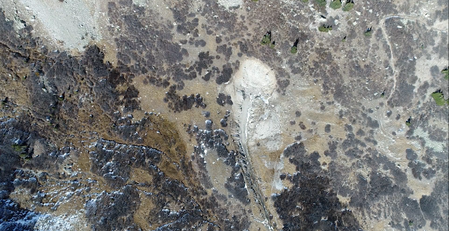
However, it is the first drone of the eastern tunnel entrance that I am aware of and shows the rock slide area above the portal and how it has fallen over the years.  There is a short jaunt over the side of the ROW fill near the tunnel.  I had hoped to recognize some of the debris down there, but alas, the footage was blurry.  A few later clips show a spot farther east along the shelf right-of-way with some rock cribbing I hadn't noticed on previous trips.

Tuesday, December 18, 2018

The Changing Face of the East Portal of Alpine Tunnel

I have visited the east portal of the Alpine Tunnel a handful of times over the last nearly 3 decades.  Each time I notice that the rock around and above the portal are strikingly different.  My visit in 2018, though, showed the most dramatic changes of all.  I decided to compile various photos of the east portal from construction to the current time to show the changes that have taken place.

It is sad, knowing that we seem to have lost sight of the arch entirely at the east portal.  However, maybe some hardy soul will someday dig another hole and find it.

In the meantime, enjoy this video.

Saturday, November 24, 2018

Train to the East Portal of Alpine Tunnel in Train-Time video

I've come across a number of online videos of the ride to the west portal of the Alpine Tunnel, but never the eastern approach, probably due to the fact that you can't drive the stretch between Hancock and the tunnel.  I really wanted to fill this gap, first for myself, because I love this side of the pass with its undisturbed grade, and also for others who haven't had the chance to see the stunning scenery and the courageous engineering of the railroad.

I got ahold of a GoPro and a chest attachment in order to make this happen.  Walking with my family (and sometimes carrying one member of it-you will see her red raincoat-covered arm occasionally) I filmed the entire length from Hancock to the east portal.

This video was filmed in July 2018.  I chose to speed up the footage to mirror the same time (30 minutes) that it took a train to travel the same distance according the C&S's schedule of October 1910.

The Denver, South Park & Pacific/Colorado & Southern line from Hancock to the east portal of the Alpine Tunnel, the highest tunnel in the world in 1881 when completed, was abandoned in 1910 in part because this stretch of railroad on the eastern side of the tunnel was so costly to maintain due to the difficulty of clearing snow from this side of the mountain.


I know it's a long video, but every bit of this route is a marvel.  I'm working on a shorter "highlight" version as well that will also incorporate still photos, including those of the interpretive signs that are posted along the way.

Sunday, October 28, 2018

Sherrod Loop 2018 video

When the DSP&P/C&S right-of-way from Pitkin to the west portal of Alpine Tunnel was converted for auto traffic, they bypassed the Sherrod Loop (or Curve) leaving the grade undisturbed all these years.   Some time ago, the United States Forest Service laid some track on the beginning, straight segment of the curve.  I think this must have been started either some time in the 1990s or early 2000s.  When I was at Sherrod in 2003 some of the rails were not yet spiked down.


The first stretch of the videos was shot with a GoPro mounted on our ATV as we travel from the site of Woodstock to the start of Sherrod Loop.  I wish I could have gotten aerial shots of the location with the drone I brought, but time limitations with our rental made this unfeasible.  Instead I took screen videos of Google Earth traversing the loop's terrain.  At the end, I walk the relaid track.  Pardon the bounce as I was using a traditional camera.  Should've used the GoPro!  Hindsight :)

Balloon Loops

It is easy to forget that the concept of the balloon loop (or switchback, though not in the traditional railroad sense) was an engineering innovation in scaling mountains.  It involved the concept of a route doubling back on itself, thereby gaining more distance in which to continue to gain more elevation.  Sherrod Loop allowed the Denver, South Park & Pacific Railroad (later, Colorado & Southern Railway) to gain elevation on its way to the Alpine Tunnel in Colorado.  After going upgrade along the mountain for many miles, passing Alpine Pass, the railroad makes a sharp turn, completely reversing it's direction, allowing it to continue the climb higher and higher to the summit and tunnel.


A Water Tank at Sherrod?

I was not aware that there was a water tank at Sherrod, but on the narrow gauge discussion forum it was pointed out that Colorado Rail Annual #31 says:
Sherrod MP 163.8
A wooden tank, 16' x 12', was constructed in 1898. Water was gravity-fed from a spring higher up the mountain.
One person posted this photo of what he surmised to be the base of this tank:


Sunday, September 23, 2018

One Mile from East Portal of the Alpine Tunnel

I have been wanting to try out using a drone, so this summer I rented one and used it in a couple of different spots near the Alpine Tunnel.

The video below is a mix of drone footage and photos.  This shows a portion of the grade just after it exits from roughly 2 miles of wooded right-of-way and begins to cling to the mountainside before reaching the eastern portal of the tunnel.  I've always loved this section of the roadbed.  I, of course, love the western side of the pass too, but because the east side was never converted for auto traffic, you can feel the narrow-ness of the grade a bit more.  This was one of my first uses of a drone so please pardon the jerky motion of parts of the video.


Historical photos:
1. James Ehernberger Colleciton
2. Tom Miller Collection

Sunday, August 26, 2018

The Other, Other Palisade

When most of us think of a palisade, we think of THE palisades-the rock retaining walls built on the upper portion of the grade leading to the west portal of Alpine Tunnel.  Some of us also might think of a very similar palisade at Ohio Pass.  This one was part of an uncompleted grade of the DSP&P.  However, there is another one without the fame of the others.

Tom and Denise Klinger point out in South Park's Gunnison Division Memories & Then Some that "About 1.3 miles upgrade from the Midway tank [on the route to the Alpine Tunnel], there is a small palisade."  In the 1880's photo below you can see a small consist posing for a portrait.  On our ride up the grade this past July, I was doubtful of being able to locate this spot, especially since the Klingers state that the "location was most difficult to locate and duplicate in 2011.  Trees have grown around the palisade and the earthen embankment has all but disappeared."  However, I wondered if there had been some clearing of trees as the spot in 2018 was now not too difficult to find.  I was able to climb down the downgrade embankment with a minor amount of sliding and "Be careful's" from my wife.

In retrospect, I wished I had planned the shot and tried to mimic the same level of the camera to get a before and after shot, but I'm too far down the embankment.

If one looks closely, I think the stones can be matched up between the two photos.  It appears that the top corner stone (close to the photographer) is now missing.  The two stones downgrade from this one are identifiable as well as the thinner stones beneath them.  I have a hard time identifying others, especially due to the differing angles.

Ed and Nancy Bathke Collection


Saturday, June 30, 2018

A Visit to Alpine Tunnel Exactly 60 Years Ago Yesterday

In June of 1958, 43 years after the abandonment of the route through Alpine Tunnel, and 25 years after the rails were pulled, Lew Schneider, a member of the US Army, made two trips to the remains at Altman Pass.  Stationed at Fort Carson near Colorado Springs, Schneider and a friend made their first trek early in June.  Starting up the eastern approach through Hancock, they ran into the same problem that often kept the C&S from getting their trains operating until mid-summer: snow.  Lew and his companion were unable to cross over the pass due to the white menace-even on June 8th!

Returning much later on June 29th, the two made a successful attempt to reach the east portal, climb the pass, and explore the complex at the west portal.

At East Portal they found the scattered remains of the snow sheds with a few beams still jutting up towards the sky.  One (or two?) of the snowshed doors is clearly visible flat on the ground.  The railroad ties are also still embedded in the right-of-way leading into the tunnel.  Having climbed up the pass they took a shot of the east portal and its approach from the top, revealing at least one or more telegraph poles still standing (one of which, I believe, is still standing today not far from Atlantic siding).
Lew Schneider
Lew Schneider

A short time later, after walking over Altman Pass, Schneider took a high up shot of the west portal station complex.  One can make out the tracks, still with rails intact, coming from the tunnel and towards the station remains.  The base of the second water tower (1906) can be seen by the side of the roadbed across from the second turntable.
Lew Schneider

After they made their way down to track level, Schneider snapped a shot of the still intact rails leading to the missing turntable.  Wooden guard rails still flanked the right side of the walkway for the worker whose job it was to turn the locos.  The guard railings on the left apparently had given way to time.  Built on top of the original debris dump from the boring of the tunnel in the early 1880s, the tracks still hold strong to their ties, though they seem to bend at sharp angles now instead of soft curves.
Lew Schneider

Walking down past the stone boarding house, the telegraph office, and the old boarding house, Schneider took a shot of the telegraph office and boarding house through the remains of the formerly arched stone entrance of the old engine house.  The wood boarding house is near complete ruin, though its side walls still remain in an upright, though disturbingly bent, angle.  The telegraph office still stands proud with right angles, though its roof, with numerous cavities, has long ago given up the fight to keep out the elements.
Lew Schneider

Finally, Schneider walked a little ways down the mainline and took a photo of the area at the place where a switch stand still stood for the parallel passing track.  The rotten ties in the foreground lead the way through a gentle curve past the still standing coal bin and on past the station, also revealing another telegraph pole defying nature.  It is nice to see just how much of the south facing engine house wall and corners were still standing at this point.  Photos from more recent times demonstrate how much of this was lost in the ensuing 50 years.
Lew Schneider

One oddity about this scene is the absence of rails at this point.  Many photos attest to rails remaining on the ties from West Portal, past the station complex and down the mountainside for at least a short distance.  It is my guess that a rockslide kept the scrapper from retrieving these rails when he salvaged them in 1923/4.  I contacted Ray Rossman, the US Forest Serviceman who managed this area for many years, asking him what happened to those rails.  He responded that the Forest Service turned the old roadbed into a drivable road on the west side in 1959, shearing off the old ties and so forth.  Schneider's visit was in 1958 and, based on his photos, some rails had already been removed, though not all of them, as demonstrated by his other photos.

Had the Forest Service already begun their work and Schneider simply visited before its completion in 1959?  While there is a documented missing rail inside Alpine Tunnel that must have been hauled off by some treasure hunter, in this case there appears to have been a length of track without rails on either side.  Who could have hauled off full lengths of rails?   Or was it a local who wanted it for some practical purpose on his farm or mine?  Who would go through the trouble of driving up to 11,000 feet, over railway ties no less, to do this?  Alas, we'll probably never know.

Source: "Lew Schneider Photo Gallery." The Narrow Gauge Circle.


Wednesday, October 11, 2017

What's the news on the palisades?

Many now know about the damage done to the Palisades by a rock fall this year, as well as another slide further downgrade, but what is being done about it.  Well, from my recent reading on the Narrow Gauge Discussion Forum...nothing.

As far as I can make out from the back and forth on the forum, the Forest Service, which owns the land, has experienced cuts in funding and also is funneling their budget towards forest fires and other more pressing concerns.

Sadly, in the meantime, that seems to mean that no repair work is in the wings and no automobiles are able to reach West Portal for the foreseeable future.

Thankfully, there are a lot of exciting C&S restoration efforts in full swing around Colorado.  Since my first love in railroading is the Alpine Tunnel, though, I hope that the restoration fever can swing down towards Altman Pass too.

Saturday, March 25, 2017

Aerial footage of a trip from Tunnel Gulch to Tunnel Lake

Check out this amazing video by a Youtube channel called "Silver Plume General Store" as they hike from Tunnel Gulch to Tunnel Lake using their drone to film the trip.  Because of the drone you get incredible shots of the topography.  My favorites include the aerial drone shots of the turntable and the very short shot about 4:21 showing the Continental Divide with the West Portal facilities in the distance.  Enjoy!

Sunday, August 16, 2015

Mysteries of Alpine - Part 1

Mysteries of Alpine
By Kurt Maechner

Dow Helmers, author of the definitive Historic Alpine Tunnel, named one of his chapters “Curse of Alpine.”  The eerie aura of four men who lost their lives working in the tunnel to the freak destruction of the town of Woodstock by an avalanche still hang in the air about the mountain.  Outside of these strange occurrences there are a number of mysteries concerning this route.  Having been abandoned long before fan trips and enthusiast visits, we are left with curious photos and the sketchy memories of those who worked the railroad to put pieces together.  I’d like to explore a few of these mysteries in a series of articles where I will attempt a bit of sleuthing to put together some answers to a few peculiar mysteries.

When you abandon a railroad you tear it up.  Look at the South Park and Clear Creek lines.  Within a year or so after abandonment the tracks were scrapped, hauled away to be melted down or used in mine shafts.  Yet, a perusal of photos of the line on either side of the Alpine Tunnel show tracks decades after abandonment.  To confuse the matter more, portions disappear at varying intervals. 

Mystery #1: The tracks of the South Park were torn up everywhere else after abandonment.  Why are there still tracks in the Alpine Tunnel to this day?  In addition, why were the tracks between Hancock and Pitkin still in place into the early 1920s? 

The tunnel was finally closed in 1910.  The reason given was: a small cave-in.  There are many who
question the significance of this cave-in.  Mac Poor states in his DSP&P book that “The cave in was not serious and could have been cleaned up; however, the management inferred that the damage was beyond repair.”  It may very well have been what the C&S management was looking for to convince the powers-that-be to allow them to finally discontinue service on this extremely expensive and operationally troublesome branch. 

However, the tracks weren’t pulled for another 13 years.  Why?  Poor states, "Due possibly to some legal stipulation incorporated in a mortgage, the rails between Hancock and Quartz were left intact for 13 years....In 1923, all the rail between these two points, with the exception of that between the east portal and a point about one mile beyond the west portal, was removed.”
In referring to this odd 13 year hiatus, Poor mysteriously uses the term “possibly” in reference to the mortgage conditions.  Yet, this is the only reference to this issue I have found in print.  Not being in the legal or mortgage profession, I would be curious to learn what kind of conditions would necessitate leaving rails down this long after abandonment. 

This unlucky number of years when the mighty Gunnison branch rails languished does explain at least one of our mysteries.  In 1923, “The C&S Engineering Department announced that due to some additional cave ins and a considerable amount of ice which had formed inside the tunnel during the 13-year period of idleness, they found it impossible to salvage any rail inside the bore." 

“Impossible” seems a bit unconvincing when you consider the plethora of reports from those who walked through the tunnel in the many decades after abandonment.  There was another reason those rails couldn’t be salvaged, or the ones down past the old engine house, but that mystery will have to wait for next time.  


Sunday, May 17, 2015

Updates to the Alpine Tunnel area

I just stumbled upon a site managed by a group called IAWC: Interpretive Association of Western Colorado.  Their site has some new photos of updated interpretive signs and displays on the western slope of Alpine Pass.

I was most impressed by this photo below showing a reconstruction of the interior of the tunnel.


I can't quite tell where this is located.  It appears to be on the grade between the Alpine Tunnel station and the west portal.

They also have many new interpretive signs along the route.


They also have pictures showing Tunnel Gulch tank in a much better condition than I last found it.

Finally, I'm not sure what this last pictures is showing.  It looks like the tunnel structure mid-construction, yet the setting appears different from the completed one.  Maybe it was built in pieces elsewhere, moved to another site, and assembled.  Not sure.  On the other hand, it has three vertical beams, while the complete one in the first photo on this post only has two.
Enjoy these improvements to a place many of us love so much!

Monday, February 2, 2009

Wednesday, January 28, 2009


This is a collection of my photos of the Alpine Tunnel area from 1991 through 2004 compared with original photos from 1880-1910.